We Test: Savvy Navvy Mobile App
I use lots of nautical apps on my phone—some for weather, some for tides, some for AIS traffic, and some for navigation.
Well, the Savvy Navvy mobile app seems to cover all of this and more, with chart overlays that forecast winds, rain, currents and tides, and pinpoint AIS targets.
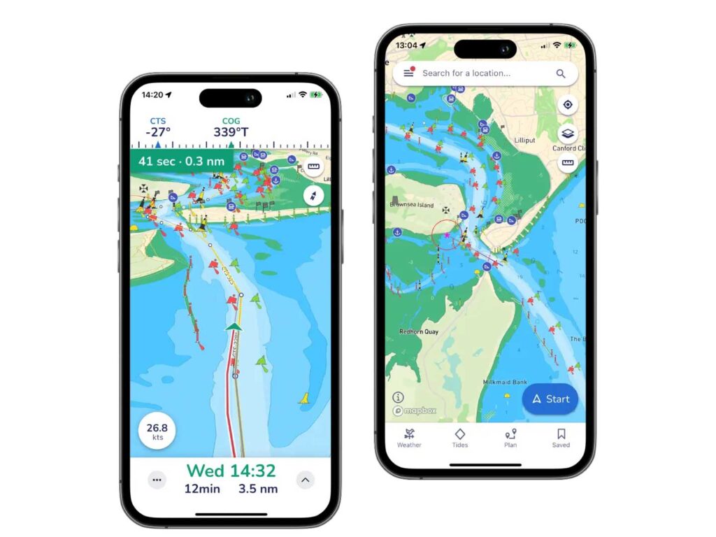 View your live position and check your Course Over Ground (COG) and Speed Over Ground (SOG) instantly. Circles around your location quickly show the distance between your boat and key features around you.
Courtesy Savvy Navvy
View your live position and check your Course Over Ground (COG) and Speed Over Ground (SOG) instantly. Circles around your location quickly show the distance between your boat and key features around you.
Courtesy Savvy Navvy
You can choose the Mapbox nautical chart, USGS satellite imagery, Maxar satellite imagery or even night mode. Plus, you can view charts in 2D and 3D formats. Plotting courses is intuitive and easy, something I cannot say of all navigation apps on my phone. And, Savvy Navvy will automatically route you around known navigational hazards, with a call-up menu describing the heading and conditions along each leg of the passage.
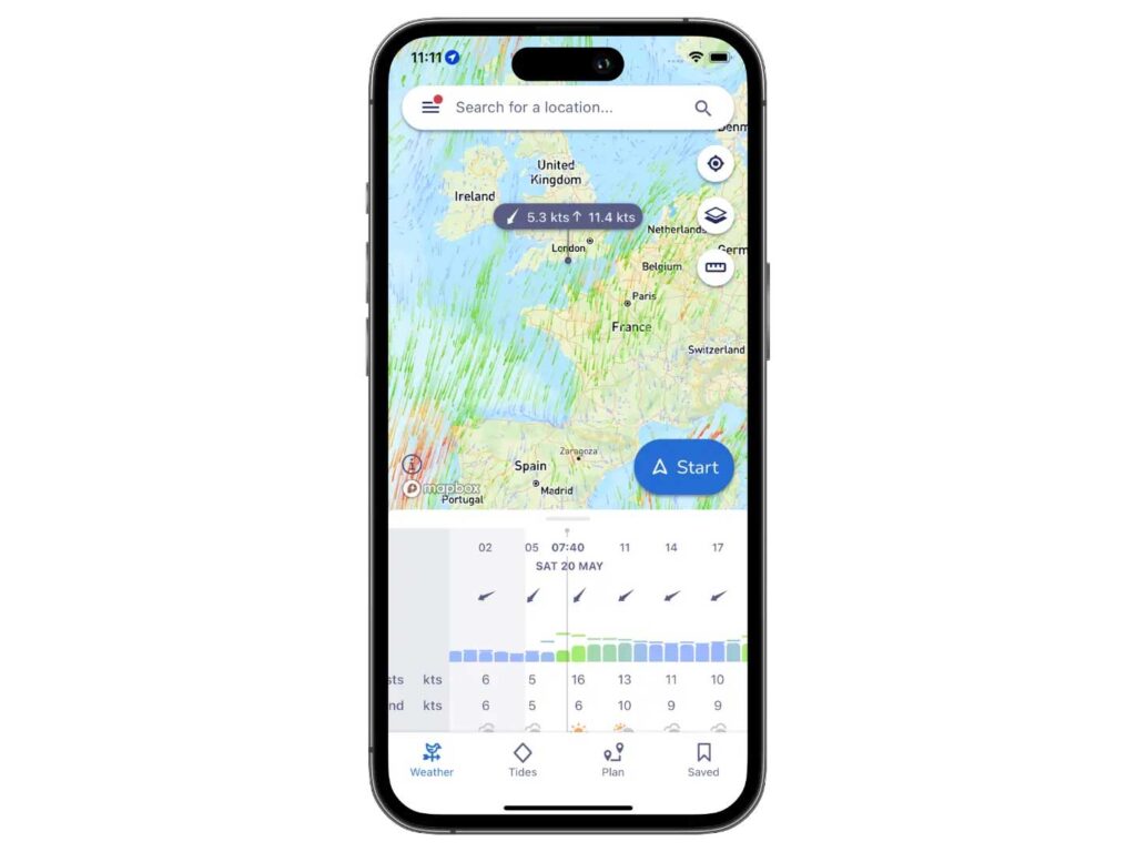 Scroll through the marine weather forecast to view the changing wind direction, speed and weather conditions.
Courtesy Savvy Navvy
Scroll through the marine weather forecast to view the changing wind direction, speed and weather conditions.
Courtesy Savvy Navvy
For sailboaters, it offers suggestions such as “wind not favourable to sail,” hinting at the app’s UK roots. There is only one element that I would add: wave forecasts, which Savvy Navvy plans to add soon.
If I could have just one nautical app, Savvy Navvy would be it.
Savvy Navvy is free—yes, free—with in-app purchases; at the App Store and Google Play.
The post We Test: Savvy Navvy Mobile App appeared first on Boating Mag.