C-Map Updates North America Charts
 Shaded Relief, which is exclusive to C-Map Reveal and Reveal X, is improved.
Courtesy C-Map
Shaded Relief, which is exclusive to C-Map Reveal and Reveal X, is improved.
Courtesy C-Map
C-Map, which makes digital marine cartography and cloud-based mapping, has issued what it calls a “major update” to its North America charts.
The charts, which countless sailors rely on for navigation all around the world, now include detailed data for hundreds of lakes, and have improved satellite imagery and enhanced shaded relief.
“We are thrilled to roll out this new update to our C-Map users in North America, significantly transforming their navigation experience,” Jakob Svensson, C-Map’s product manager, stated in a press release. “Our product team is dedicated to sourcing new data and continually enhancing and improving our charts.”
The new data incorporates satellite imagery improvements in 19 states, including, North and South Carolina, and Washington.
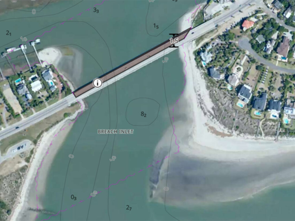 Satellite imagery improvements for C-Map Reveal are detailed down to 1-meter resolution across Florida, the East Coast and the Gulf Coast.
Courtesy C-Map
Satellite imagery improvements for C-Map Reveal are detailed down to 1-meter resolution across Florida, the East Coast and the Gulf Coast.
Courtesy C-Map
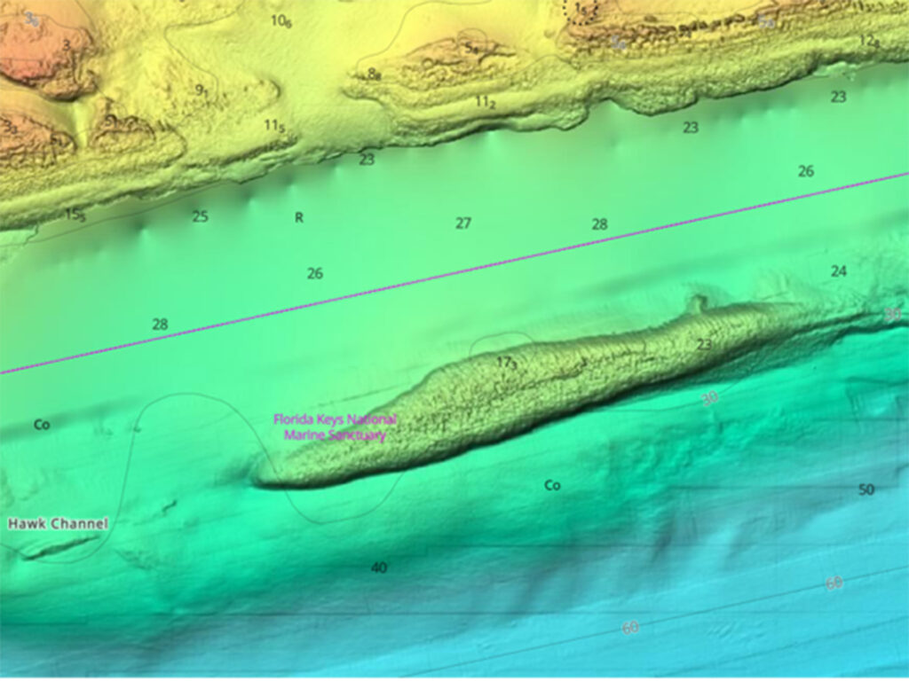
Shaded Relief, which is exclusive to C-Map Reveal and Reveal X, is improved across more than 500 lakes, including the Great Lakes, and for coastal areas such as the Bahamas, Florida Keys and San Francisco.
Information for 13,000 bridges with enhanced geometry and positioning, and the addition of vertical and horizontal clearances to more than 6,400 bridges, has also been added for safer navigation.
There also are more than 300 improvements for navigable locks, significantly improving the geometries and positional accuracy.
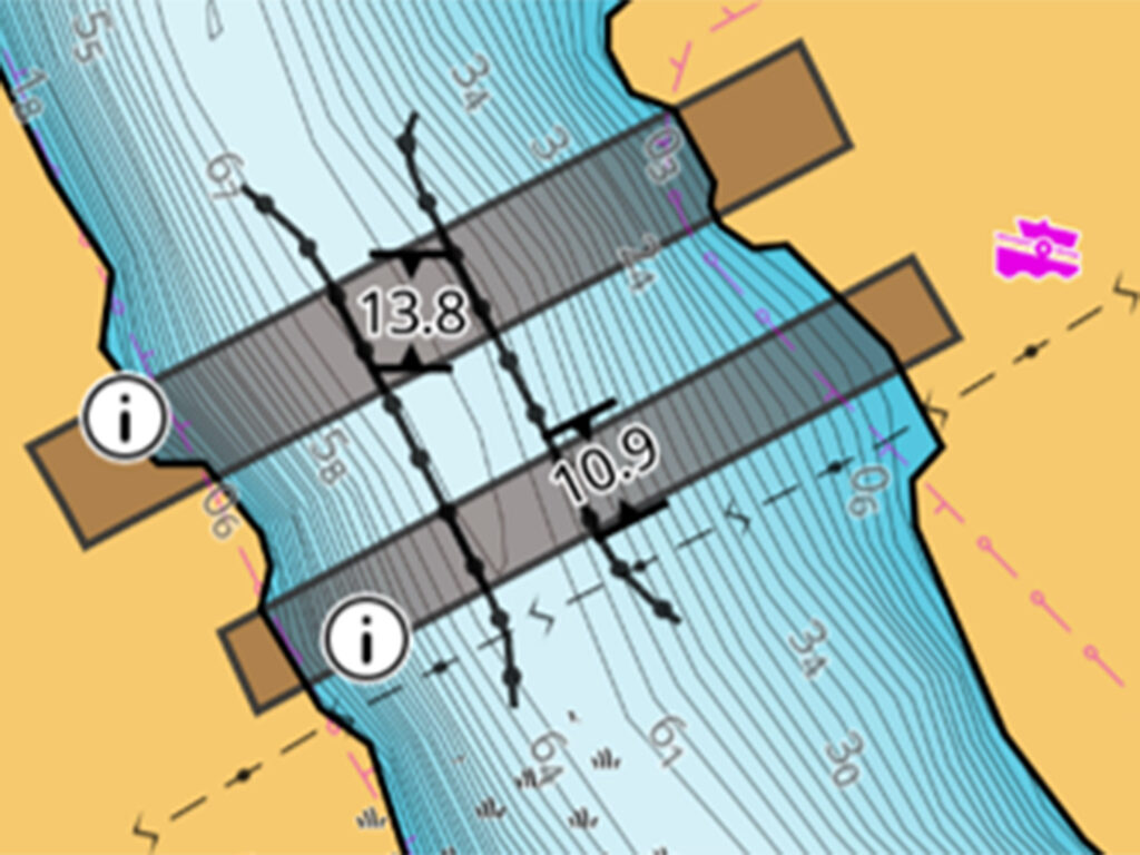 Information for 13,000 bridges has been added for safer navigation.
Courtesy C-Map
Information for 13,000 bridges has been added for safer navigation.
Courtesy C-Map
According to the company, satellite imagery improvements for C-Map Reveal are detailed down to 1-meter (about 3-foot) resolution across Florida, the East Coast and the Gulf Coast. Satellite imagery improvements for C-Map Reveal X include North and South Carolina, Washington and Rhode Island. High-resolution bathymetry updates include coastal areas such as the Bahamas, Florida Keys and San Francisco.
New raster charts for Reveal X provide a paper-chart experience for a more traditional look.
C-Map is part of Navico Group, which is a division of Brunswick Corp. The company offers one of the world’s largest marine navigation digital chart databases. Its portfolio includes the Discover, Reveal and 4D chart ranges, which integrate with fishfinders and chartplotters from the leading marine electronics brands, and via the C-Map app.
About Brunswick Corp.: Being part of Brunswick Corp. means being part of the world’s leading supplier of integrated systems and products to industries ranging from marine to recreational vehicle and beyond. The corporation includes the engine-maker Mercury, along with boatbuilders such as Bayliner, Boston Whaler, Crestliner, Lund, Sea Ray and Protector. Newer boat brands include Navan and Veer. The Navico Group’s brands include Ancor, Attwood, B&G, BEP, Blue Sea Systems, C-Map, CZone, Lenco, Lowrance, Marinco, Mastervolt, MotorGuide, Progressive Industries, ProMariner, RELiON, Simrad and Whale.
Where to learn more: click over to c-map.com
The post C-Map Updates North America Charts appeared first on Cruising World.