Cruising the Northwest Passage
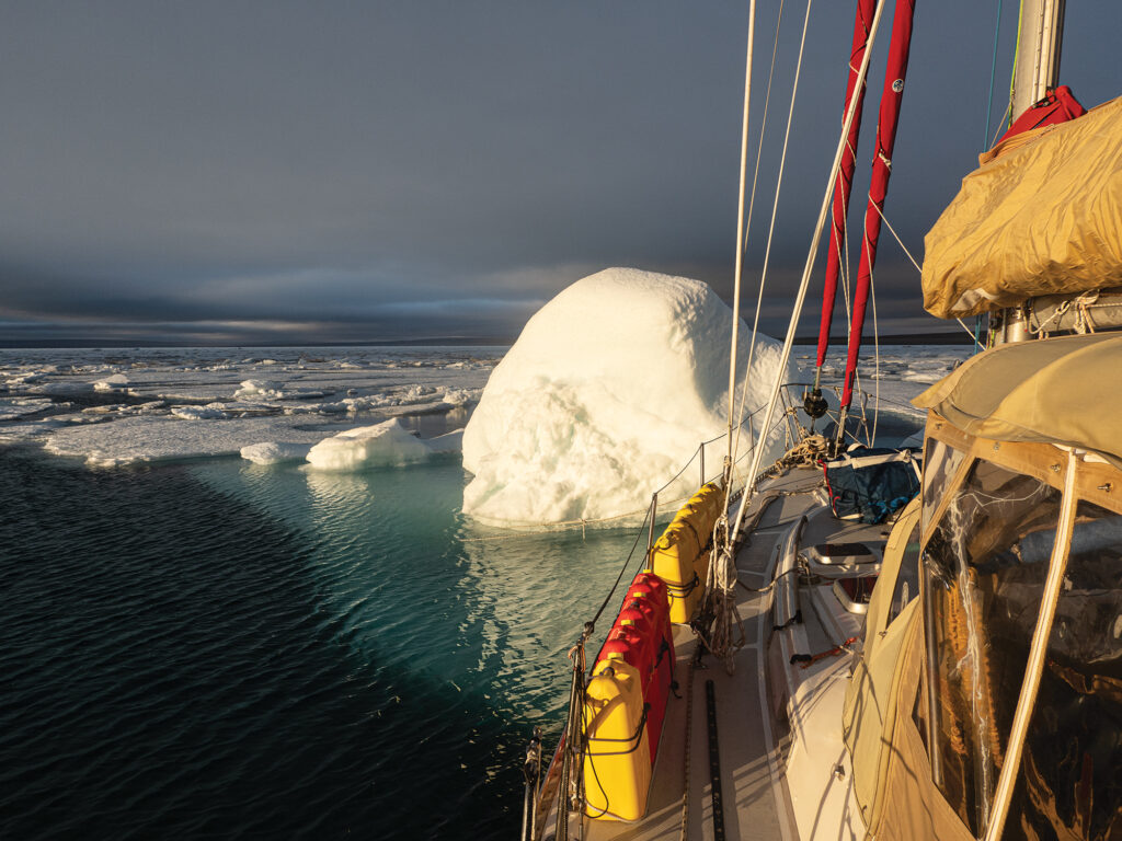 Trapped by pack ice, the Stevens 47 Polar Sun spent nine days moving from floe to floe in Pasley Bay in Nunavut, Northern Canada, to avoid being dragged aground.
Ben Zartman
Where does the fabled Northwest Passage—that tenuous, long-sought sea route between the Atlantic and Pacific oceans—properly begin?
For the keepers of official records, jealously counting how many of each sort of boat makes the transit each year, the answer is the Arctic Circle, at 66°30′ N. It begins when you cross into the Arctic going northward, and it ends when you cross out of it again southbound, 100 degrees of longitude away.
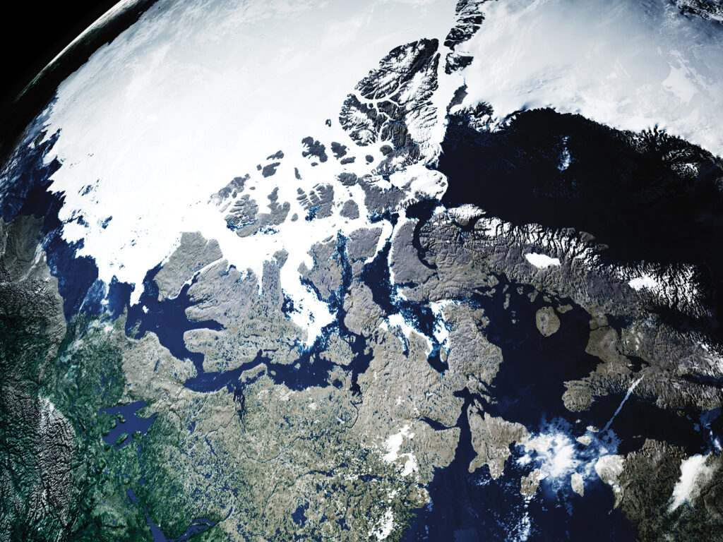 Only in the past 15 years or so has enough sea ice given way to allow pleasure boats to complete the Northwest Passage.
Manuel Mata/stock.adobe.com
Others—often those attempting to kayak, paddleboard, kitesurf or dinghy across—count it from Pond Inlet at northern Baffin Island to the hamlet of Tuktoyaktuk, which is nearly on the US-Canada border. That’s a far shorter distance, and it cuts out nearly 1,000 miles of the difficult coast of Alaska, not to mention about 500 miles on the Atlantic side.
Surely, we can forgive those with the audacity to try it in any sort of open craft. With our Stevens 47, Polar Sun, however, although we had crossed the Arctic Circle halfway through a cruise of Greenland’s coast from Nuuk to Ilulissat, we didn’t feel like our bid for the passage had properly begun until we wriggled out of the untidy raft-up of sailboats at the fish wharf in the inner harbor at Ilulissat. It was midafternoon and raining lightly as we dodged past icebergs at the harbor mouth, but neither time nor atmospheric moisture matters a whole lot in a place where the sun doesn’t set and you’re bundled head to toe against the cold anyway.
Having been going hard for weeks on end, with uncertainty and ice and everlasting cold, it was the longest sailing leg of my life.
We were bound across Baffin Bay for Pond Inlet, a four-day leg that took us closer to seven, and taught us that just because we’d gotten to Ilulissat ahead of schedule didn’t mean we were always going to get easy sailing.
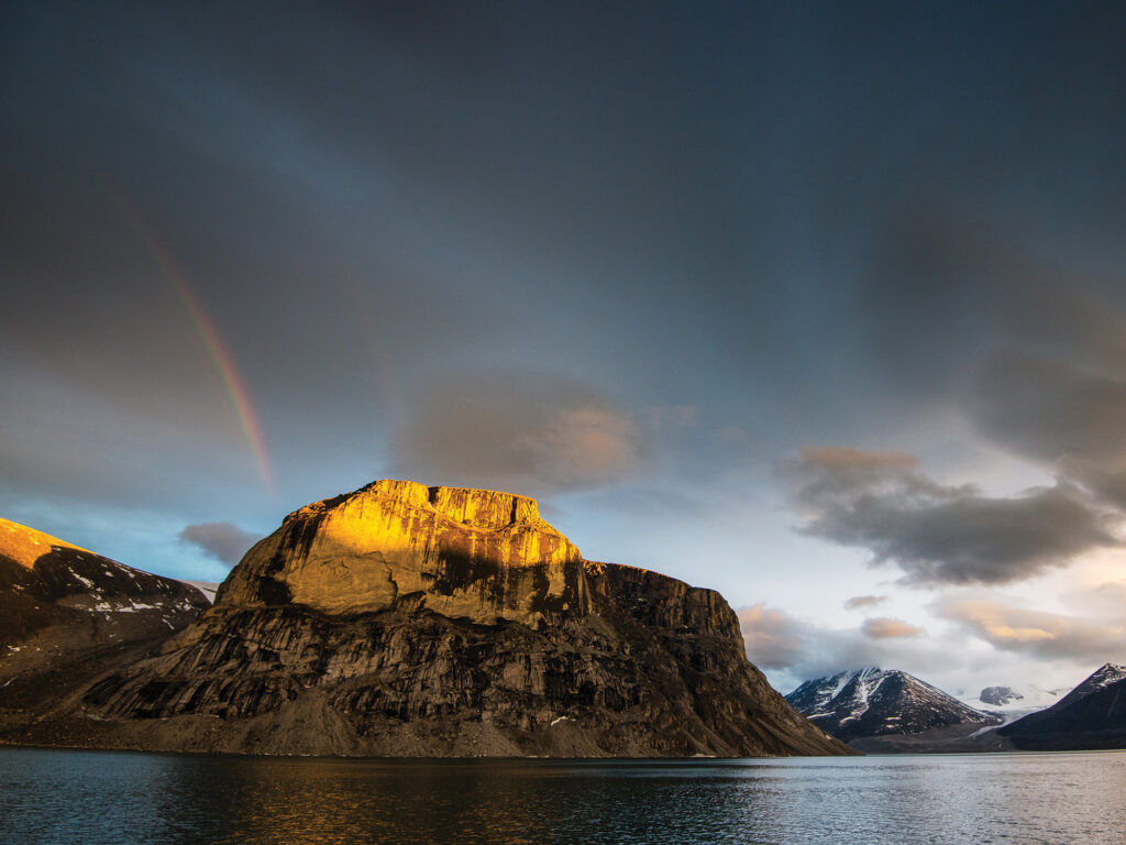 Baffin Island basks in the midnight sun. The spectacular, wild landscape is an accessible Arctic playground for the adventurous.
Jillian/stock.adobe.com
We were used to icebergs by then. They’re mostly huge and visible. They’re easy to sail around, and their dangers are predictable and avoidable. But halfway across Baffin Bay, we encountered pack ice for the first time. We found it a far more chilling prospect. Being mostly flat and close to the surface, it doesn’t show up well on radar or forward-looking sonar, and it tends to hang tight. If you see one floe, there’s probably a whole bunch of them nearby, drifting amiably around together.
By the time we beat our way against a 20-knot breeze close to the craggy Baffin Island shore, we were hardly surprised to find icebergs drifting amid the barrier of pack ice that blocked the shore. Who says you can’t have it all?
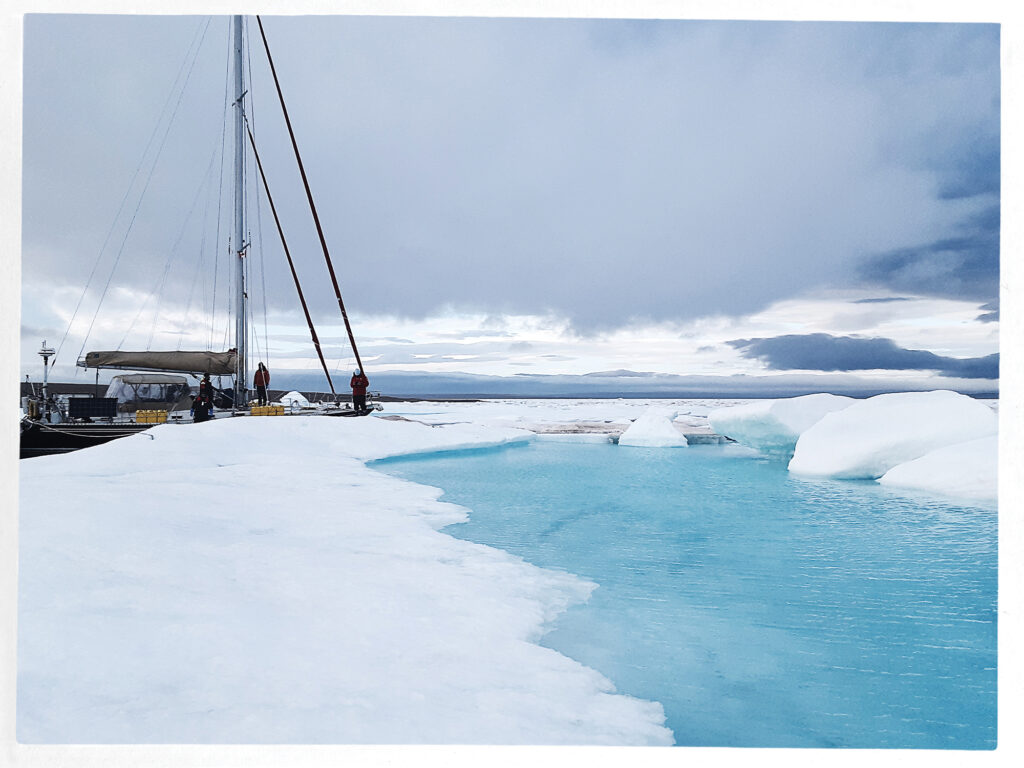 Polar Sun, tied to a floe with ice screws in Pasley Bay.
Ben Zartman
When we had finally worked our way through the ice and up along the coast for another day, we were in for several surprises. The first was that a brand-new harbor with breakwalls and docks had just been built at Pond Inlet, so we didn’t have to anchor in a rolly roadstead like we had expected. The second was that although the town there was relatively close to Greenland, it couldn’t have been more different than the ones we’d just left. Lacking the warm current that Greenland enjoys, this area stays locked up in ice most of the year. There isn’t a whole lot to do in one place, and it’s easy to see why the native Inuit were once nomadic. It makes sense in a place where nature is so savage.
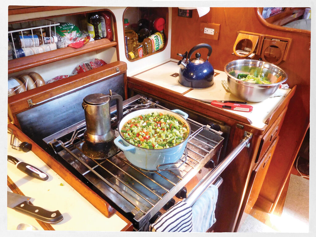 A warm pot of lentil stew in the galley.
Ben Zartman
Pond Inlet was the first of only four settlements we visited in the next 2,000 miles. Between them lie mind-numbingly vast stretches of barren, cliff-filled islands where even lichens struggle to grow in the whorls and rings of frost-heaved gravel.
We didn’t linger too long in any one place—at least, not by choice—but hastened always, feeling the shortness of the navigable season, and knowing that the later we got to the Bering Sea, the better chance we had of getting clobbered by something nasty. After an iceberg-fraught, lumpy, breezy passage of the Navy Board Inlet, we had an exceedingly pleasant sail diagonally up Lancaster Sound to Beechey Island.
Between the Beechey and King William islands is where the most pack ice can be expected. Some years, it’s so abiding that no small boats get through. We were lucky. A violent south wind flushed all the ice out of Peel Sound, our projected route. After a day anchored in Erebus and Terror Bay, a band of pack ice that had barred the way opened up just enough for Polar Sun to get through.
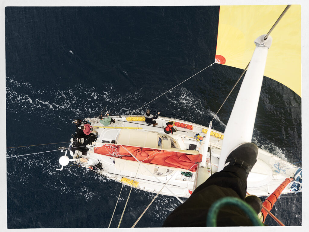 A view from the spreaders, where we climbed often to spot a path through the ice.
Ben Zartman
I had always heard of iceblink, a phenomenon where distant pack ice throws a glow along the horizon, making it impossible to judge how far off it is. I had thought I wanted to see it someday, but I realized as we raced toward the rapidly shrinking opening to Peel Sound that I could have done without it, at least when a fogbound island, a foul current and a whole lot of ice coming out of the blink were converging on Polar Sun.
It wasn’t the last time we would squeak through a narrow gap at the last minute. The next 500 miles saw us often in and out of ice. Twice, we were denied passage out of a bay where we ultimately spent nine days trapped in the pack, shifting from one ice floe to another. We almost didn’t make it out of there at all, and when we did, it was to find the way nearly shut farther along.
At last, though, we made it to Gjoa Haven on the south side of King William Island. We sighed with relief that the ice, at least, would trouble us no more—but given the trouble we did see for the next several thousand miles, perhaps a little ice would have been the least of it.
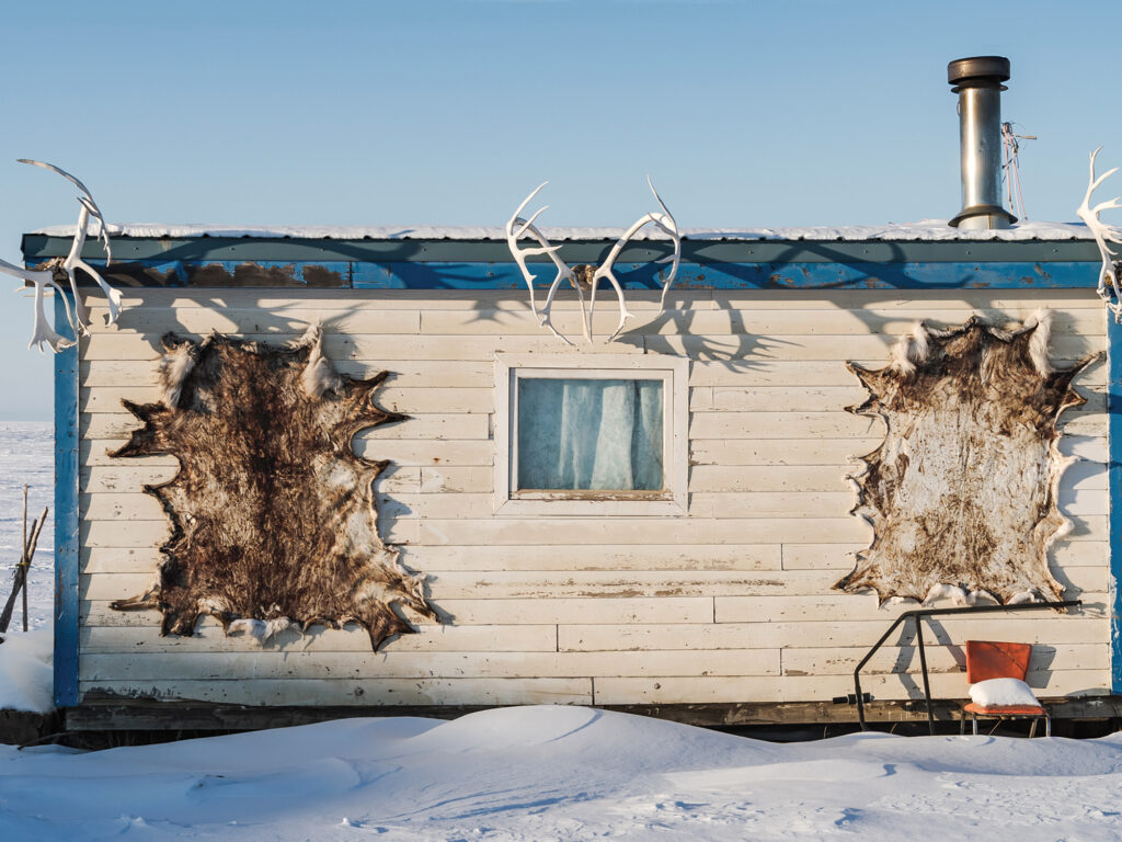 a typical shack the Canadian government supplied to the Inuit once upon a time.
Evan/stock.adobe.com;
What we hadn’t accounted for was that Gjoa is barely halfway across the Northwest Passage. There was still such a long way to go, and now, each night was dark for a little longer than the prior.
Given the lateness of the season—those nine days in the ice had really set us back—we considered leaving the boat in Cambridge Bay for the winter, but the crane that had once hauled the occasional stray sailboat was no longer there. To leave the boat in the water would be to lose it. We had already lost two crew, who had to return home for work, and couldn’t lose the time to find more.
So, Mark Synnott, the expedition leader, and I doublehanded the six weary days to Tuktoyaktuk. It’s not that doublehanding is normally that bad, but having been going hard for weeks on end, with hopes raised and dashed, with uncertainty and ice and everlasting cold, it was the longest sailing leg of my life. Before we finally rounded Cape Bathurst and raced with a strong following wind into Tuk, we had spent eight hours hove-to in a midnight blow, overheated the engine, sailed the wrong direction with a lee shore wherever we could point the bows, and did I mention the cold?
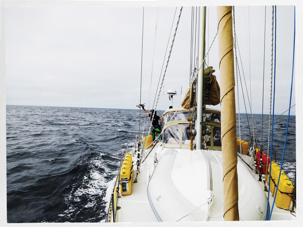 Crewmember Eric Howes catches a camera drone while underway.
Ben Zartman
Tuktoyaktuk is on the shallow, oil-rich shelf of the Beaufort Sea. The channel barely carries 2 fathoms into the harbor at the best of times. This was not one of those times; the strong wind that rushes unopposed over the featureless peninsula tends to blow water out of the harbor. Polar Sun grounded gently just abeam of the half-wrecked public wharf. We got lines ashore to take in when the tide should float her again, and we went ashore to eat with the relief crew, who had flown out to meet us.
Without that extra crew, that last leg across the north coast of Alaska and down to the Bering Sea would have been not just exhausting, but also dangerous. Even with the new life that David Thoresen and Ben Spiess breathed into our souls, the strong following wind and seas required constant watchfulness. We rounded Point Barrow, the northernmost point in Alaska, in a welter of muddy, breaking waves, with sleet whitening the weather side of every shroud and halyard. We had thought of stopping in Barrow for a rest, but the seas were too rowdy along the shore. Besides, the wind was fair to sail south, and south is where we wanted to go.
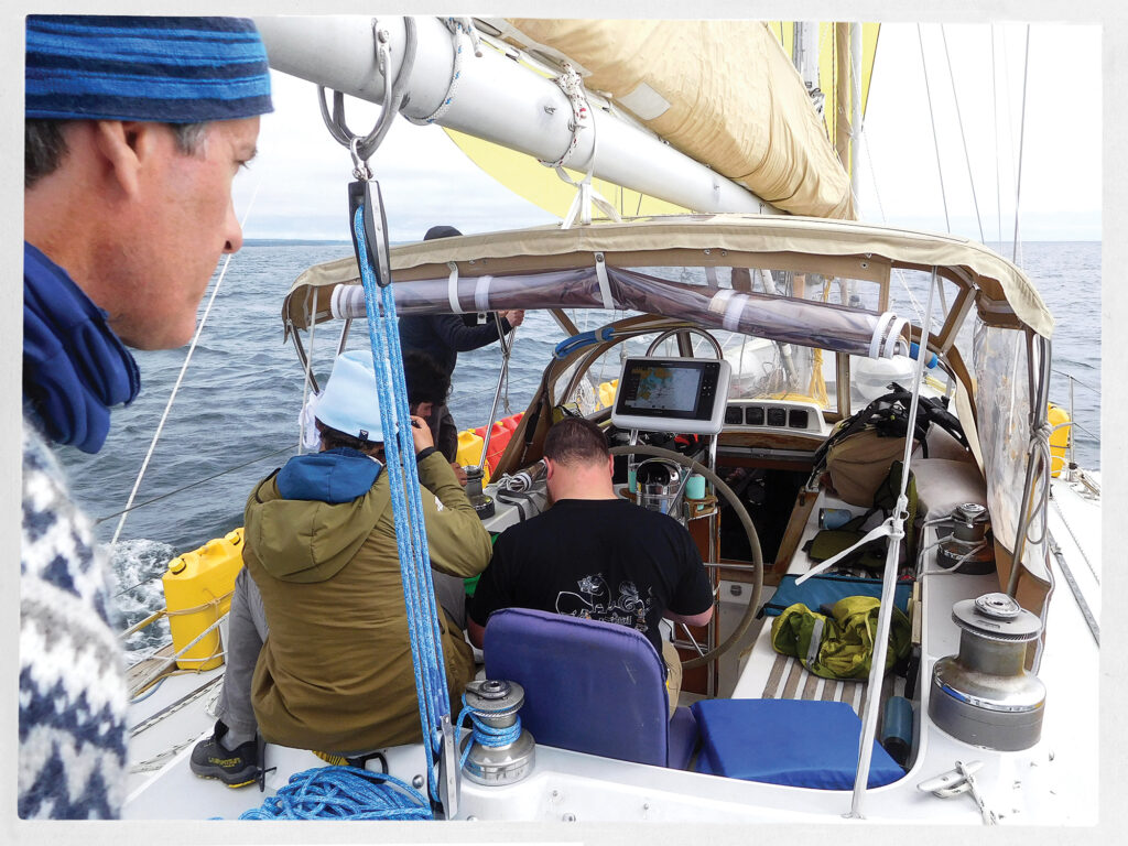 The crew on the aft deck, with expedition leader Mark Synnott in the foreground.
Ben Zartman
South, that is, until Point Hope, where we needed to tuck in and hide from a typhoon—yes, a typhoon. It had strayed beyond its reasonable bounds into the Bering Sea, not only bringing record flooding to the coastal communities, but also having the audacity to pass through the Bering Strait into the Chukchi Sea, where Polar Sun sheltered in the tenuous lee of a permafrost-topped sandbar.
The eye of the storm, still well-defined although weakening, came abeam of our anchorage and made it untenable. We weighed anchor for the last time and sailed deep-reefed straight toward the center of it. Tacking some hours later to claw across Kotzebue Sound, we had occasion to wish that Cambridge Bay had worked out. The wind drove Polar Sun farther from the Bering Strait, toward a shoreline guarded by poorly charted shallow sandbars and lagoons.
It was nearly dark when the wind relented enough that we could make a run toward Cape Prince of Wales. That was the last obstacle, and we hand-steered around it in pitch-blackness, hugging the shore as close as we dared to avoid a current offshore. With the lights of Wales close abeam, and with Polar Sun surfing at 9 knots down-sea, we were grateful that we couldn’t see.
Once properly in the Bering Sea, all the jumble of the strait settled down, as if turned off with a switch. We motored sedately into Nome, Alaska, in the late afternoon, just hours ahead of the next southerly gale that pounded that unforgiving coast.
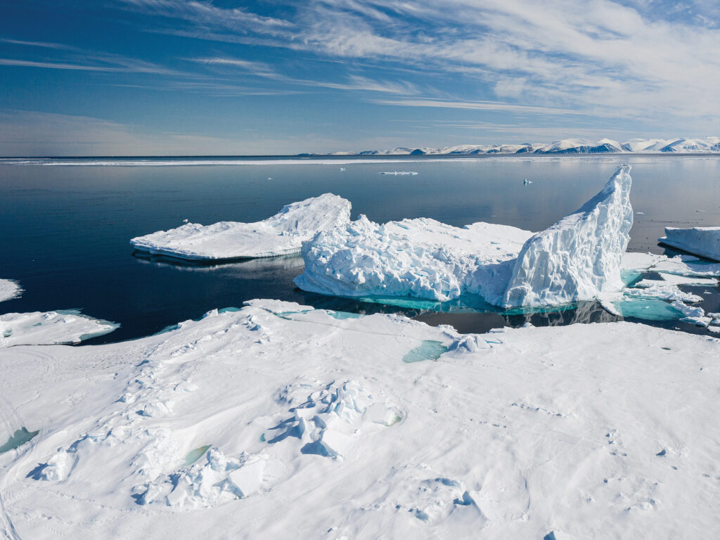 Bright, radiant ice and glassy calm water as far as the eye can see are typical of any Greenland scene around Pond Inlet.
Colin/stock.adobe.com
For the record-keepers, the Northwest Passage was officially completed halfway across Kotzebue Sound, when Polar Sun crossed the Arctic Circle just north of the Bering Strait. For Mark and me, the only two of the 12 people on the trip to sail every mile, it wasn’t fully over even in Nome. There were sails to unbend and stow, halyards to messenger out. A whole winterization had to be done, and there were long flights, which undid in 12 hours the distance we had taken 112 days to sail, to endure.
Where does the Northwest Passage end? For me, at least, it ends when you get home.
The post Cruising the Northwest Passage appeared first on Cruising World.
- Home
- About Us
- Write For Us / Submit Content
- Advertising And Affiliates
- Feeds And Syndication
- Contact Us
- Login
- Privacy
All Rights Reserved. Copyright , Central Coast Communications, Inc.